Poster Title: Mapping and Monitoring Rice Agriculture in Bhutan Incorporating Climate Variability Using Remotely Sensed Data
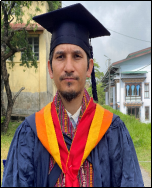
Mr. Indra Bahadur Chhetri received his Master of Engineering in Civil and Earth Resources Engineering (Geo-informatics), in March 2022, from Kyoto University, Kyoto, Japan, and his Bachelor of Engineering (Civil Engineering), in June 2014, from the College of Science and Technology, Royal University of Bhutan. Mr Indra is currently working as an associate lecturer in the Department of Civil Engineering and Surveying at Jigme Namgyel Engineering College, the Royal University of Bhutan since joining the institution in the year 2014. He has availed the prestigious scholarship of the Sustainable Development Goals (SDGs) Global Leadership Program under the framework of the Japan International Corporation Agency, Development Studies Program (JICA-DSP) to undergo a Master in Civil and Earth Resources Engineering at an esteemed university, Kyoto University, Japan. His research interests are mainly in earth resources, geo-information (GI), geo-statistical analysis, application of GIS in transportation and geohazards, Geo-spatial data quality assessment, and Drone technology.
Professional Experience:
- Associate Lecturer, Jigme Namgyel Engineering College since August 2014.
- Program leader, BE in Surveying and Geo-informatics and Diploma in Surveying, July
2022 -now
- Member representative of the Centre for GIS Coordination (CGISC), Department of
Survey & Land Records (DSLR) under National Land Commission Secretariate (NLCS),
2015-2019.
Educational Background:
- Masters of Engineering in Civil and Earth Resources Engineering (Geo-informatics),
March 2022, Kyoto University, Kyoto, Japan.
- Bachelor of Engineering (Civil Engineering), June 2014, The Royal University of Bhutan.
